| Area |
Middle Trinity |
| Topic |
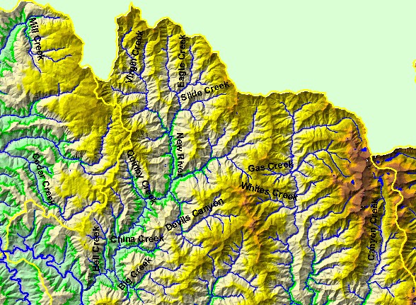
Map: 1B. Elevation and Hydrography, Middle Trinity Sub-basin - North |
|
This map is a hillshade of Digital Elevation Model (DEM) showing the topography of the landscape in the northern portion of the
Middle Trinity basin, displayed with hydrography and sub-basin boundaries. The terrain is steep, and the New River and North
Fork Trinity River are the major streams in this part of the sub-basin. Data were contributed by the U.S. Geological Survey and
the Trinity County Resource Conservation District.
|
|
|
 |
 |
To view metadata about a map layer, click on a link in the table below.