| Area |
Lower Trinity/Basin-wide |
| Topic |
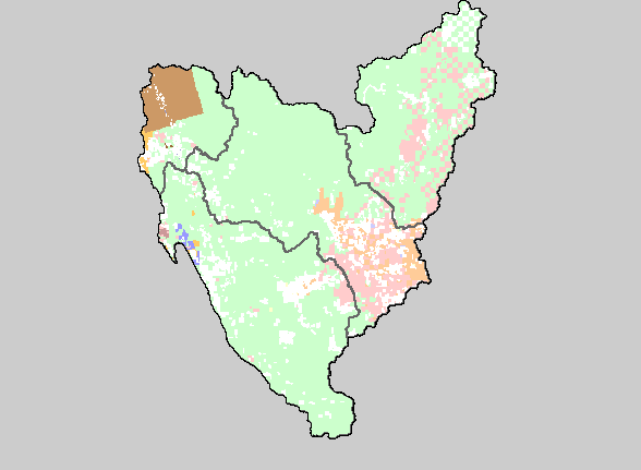
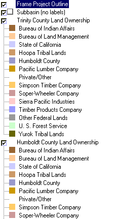
Map: 1H. Land Ownership, Trinity Basin |
|
This is a map of the land ownership in the Trinity basin, displayed with KRIS sub-basins. The U.S. Forest Service (pale green) is
by far the largest landowner in the Trinity River basin. The second-largest landowner in the basin is Sierra Pacific Industries (pale
pink). The Hoopa Tribe of California reservation (reddish-brown) is located at the northwestern corner of the Trinity Basin. The
U.S. Bureau of Land Management (yellow) owns sizeable tracts of land south of Trinity Lake.
|
|
|
 |
 |
To view metadata about a map layer, click on a link in the table below.